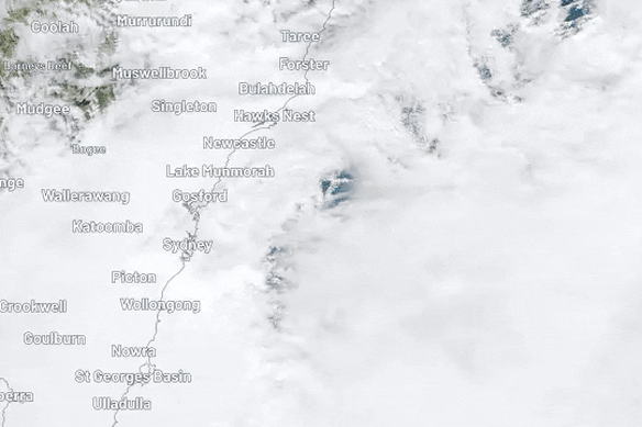
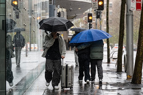
Welcome to our coverage of the “bomb cyclone” event currently lashing coastal NSW, after a night of wild weather brought down trees and cut power to thousands of homes, with the severe weather forecast to continue.
Here’s what you need to know.
- More than 36,000 homes are without power in Sydney and the Central Coast, after last night’s wild weather lashed the coastline.
- The SES responded to more than 2000 jobs statewide, with active evacuation orders in place for parts of Wamberal and The Entrance due to dangerous coastal erosion.
- The vigorous low-pressure system is now sitting off the Illawarra, and is expected to continue lashing Sydney and the South Coast today.
- Severe weather warnings remain in place for damaging winds and heavy rainfall across much of coastal NSW today.
- Sydney could see winds averaging 60 to 70km/h, as well as destructive gusts of around 100km/h.
- The South Coast is on high alert for heavy rainfall that could lead to flash flooding, with up to 120mm of rain expected today.
- The rainfall forecast is expected to ease in the afternoon, while the wind will ease by tomorrow.