Strong winds, flights cancelled as Brisbane feels effects of ‘bomb cyclone’
We’re sorry, this feature is currently unavailable. We’re working to restore it. Please try again later.
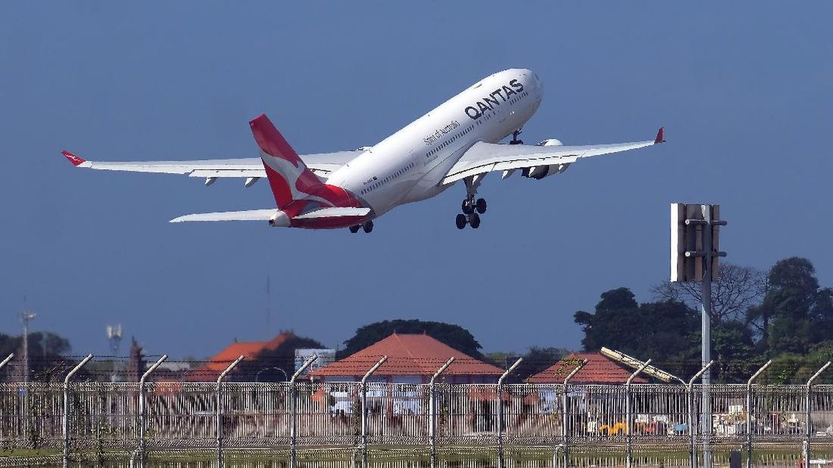
Strong winds buffeting Brisbane have grounded aircraft, as south-east Queensland feels the effects of a “bomb cyclone” lashing parts of NSW.
Winds are expected to reach gusts of up to 100km/h in some parts of south-east Queensland, in what might feel like a premature start to the August Ekka winds.

Brisbane is being hit with strong winds as a result of the NSW “bomb cyclone”.
The extreme weather in NSW has forced flight cancellations and delays between Brisbane and Sydney.
At least eight flights were cancelled on Wednesday morning.
The blustery conditions are the result of an unusual low-pressure system off NSW the Bureau of Meteorology has called a “bomb cyclone”.
Millions of residents are hunkering down and thousands are without power as torrential rain, savage winds and waves up to eight metres continue to hit the NSW coast because of the deepening low-pressure storm system.
Communities stretching from Queensland’s Lockyer Valley to Bega on NSW’s south coast are being warned to take care.
What is a ‘bomb cyclone’?
Meteorological jargon used to describe the unusual low-pressure storm system has included “bomb cyclone”, “bombogenesis” and “explosive cyclogenesis”.
These terms refer to the rapid intensification of the weather system. A dramatic plunge in pressure – about 20 to 30 hectopascals over the past day or two – transformed the low into a severe storm system. Regions of low pressure in the atmosphere funnel air upwards, which triggers the development of storm clouds and powerful winds.
Loading
The system the bureau called a “vigorous coastal low” spiralled down the coast while generating storm-force offshore winds comparable with a category two cyclone, said Steve Turton, adjunct professor of environmental geography at CQUniversity.
“That’s certainly going to increase the wave energy and the swells and so on coming onto the coast. We’re looking at over 5 million people likely to be affected by this system,” he said.
Abnormally warm water off the NSW coast helped fuel the rapid intensification, Turton said. Warmer oceans turbocharge storm energy and supply weather systems with moisture for heavy rain.
A region of ocean water brewing 1 to 3 degrees above the long-term average also contributed to Cyclone Alfred and May’s flood disaster, Turton said.
The “bomb cyclone” was expected to track south on Wednesday before turning back out into the Tasman Sea on Thursday.
The official forecast for Brisbane on Wednesday was sunny and windy, with westerly winds about 30km/h to 45km/h, reaching possible gusts of 60km/h.
The damaging winds might persist in parts of south-east Queensland until tomorrow morning.
Most Viewed in National
Loading