NSW, Victoria and South Australia will endure searing hot days, warm nights and elevated bushfire risk later this week, as a wall of heat moves from the north-west coast of Western Australia across the continent.
The first big heatwave of the summer comes after 2025 clocked in as Australia’s fourth-warmest year on record, while new figures show the number of people living in bushfire-prone outer suburbs has more than doubled in Melbourne and Perth this century and risen by double-digits in other capital cities.
The Bureau of Meteorology is expecting a severe to extreme heatwave to hit the mainland south of a line from Tibooburra in far western NSW to Newcastle. Even parts of Tasmania are forecast for low to locally severe heatwave conditions.
Senior meteorologist Dean Narramore said the heatwave was the “first major burst of heat for south-eastern Australia this summer”.
“You normally get that one hot day … then it gets cool again as that front sweeps across. With this event, we’re looking at three days in a row – in some areas, possibly four days in a row – of daytime temperatures in the mid to high 40s, but even minimum temperatures in the mid-20s.

Henry, 10, and Toby, 7, McGarry from Faulconbridge hose off after a swim at Penrith Beach on a previous scorcher in early December.Credit: Sitthixay Ditthavong
“The reason it’s lasting so long is we have a large high-pressure system in the Tasman Sea – it’s almost caused a traffic jam, stopping the weather moving from west to east.”
The forecast was for daytime highs being eight to 16 degrees above average, and night minimums to be 10 to 15 degrees above average, Narramore said. A heatwave is defined as three consecutive days in which both the maximum and minimum temperatures are well above average for the time of year.
Adelaide and Melbourne were likely to exceed 40 degrees on Wednesday, Narramore said, while it would hit Canberra and western Sydney later in the week.
Melbourne was expected to cool to the low to mid-30s on Thursday, but the temperature was expected to soar again on Friday before a stronger cool change.
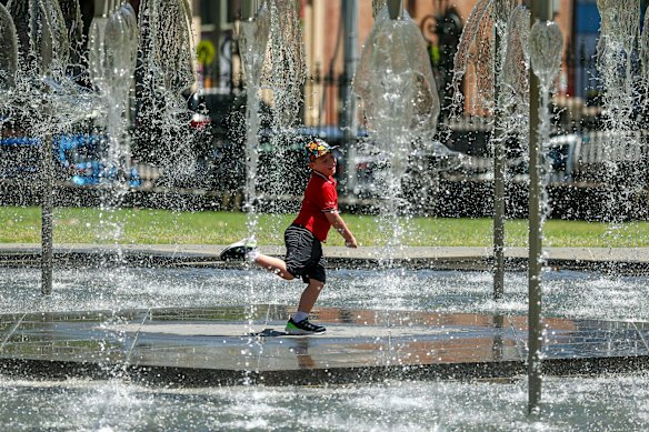
People cooling off in the fountain at Spring Street in Melbourne in late December.Credit: Eddie Jim
The sea breeze would be the saving grace in the eastern parts of Sydney, keeping temperatures down to the low 30s for most of the week, Narramore said, although it could hit 39 degrees in the city itself on Saturday.
Suburbs west of Olympic Park were on track for three days in a row in the low 40s. Penrith would be 37 degrees on Wednesday, 41 on Thursday, 41 on Friday and 44 on Saturday, without significantly cooling at night.
That translated to extreme fire danger in southern parts of South Australia on Wednesday and high fire danger for much of south-eastern Australia on Wednesday and Friday, Narramore said. The wind could pick up on Friday, he added, meaning widespread extreme fire danger in South Australia and western Victoria on Friday and then eastern Victoria and south-eastern NSW on Saturday, ahead of the cool change.
January 6 is the anniversary of last year’s Los Angeles fires, and the Climate Council has put out a report warning that massive urban fires of the same scale could happen in Australia.
Australian fire conditions have been worsened by drying conditions caused by climate change, the report says, while millions more people live in outer-suburban areas that are most at risk of bushfires threatening residential areas.
There are now more than 2 million people living on the urban fringe of Melbourne – up 111 per cent from 2001 to 2024. The population on the urban fringe of Perth has also more than doubled. Sydney has 1.6 million people living on the urban fringe, up 24 per cent over the 23-year period.
Andrew Gissing, chief executive of Natural Hazards Research Australia, said research suggests that less than half of Australians had emergency plans or emergency kits prepared for bushfires, heatwaves and other disasters.
Loading
Bushfire risk was worsening for three reasons, Gissing said, starting with climate change, which meant severe fire weather was occurring more frequently and fire seasons were lasting longer.
“We’re also seeing the growth in the number of people living in at-risk areas … and degradation of the environment is contributing to natural hazard risk,” he said.
The average annual temperature for Australia in 2025 was 21.8 degrees – 1.23 degrees above the 1961-90 baseline – official figures show.
Weatherzone meteorologist Ben Domensino said in a blog post that the hottest year on record was 2019, when it was 1.51 degrees above the long-term average. The second hottest was 2024 (1.45 degrees above average) and the third hottest was 2013 (1.35 degrees above average).
Globally, 2025 was tracking to be the equal second-hottest year on record, the European Union’s Copernicus agency said in November.
Get to the heart of what’s happening with climate change and the environment. Sign up for our fortnightly Environment newsletter.
Most Viewed in Environment
Loading