2 weeks ago
2
2 weeks ago
2
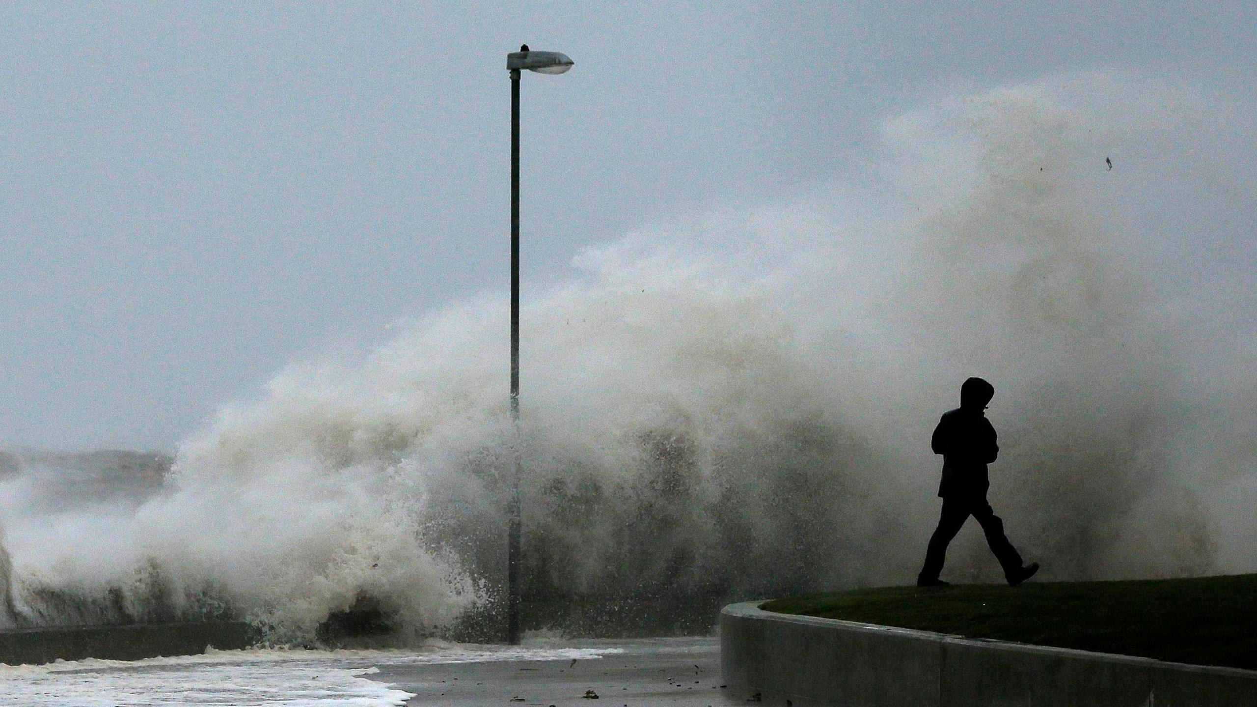 Image source, Reuters
ByDarren Bett
Lead Weather Presenter
Hurricane Gabrielle is only the second major hurricane of the Atlantic hurricane season, forming less than a week ago in the mid tropical Atlantic.
It has rapidly intensified as it approaches Bermuda but will take a sharp turn to the right before arriving.
Current weather models show it getting caught in a weather front moving eastwards across the Atlantic steering instead towards Europe.
Whilst Gabrielle will weaken as it travels there is still the chance it will result in a wet and windy end to what has already been a very soggy September in the UK.
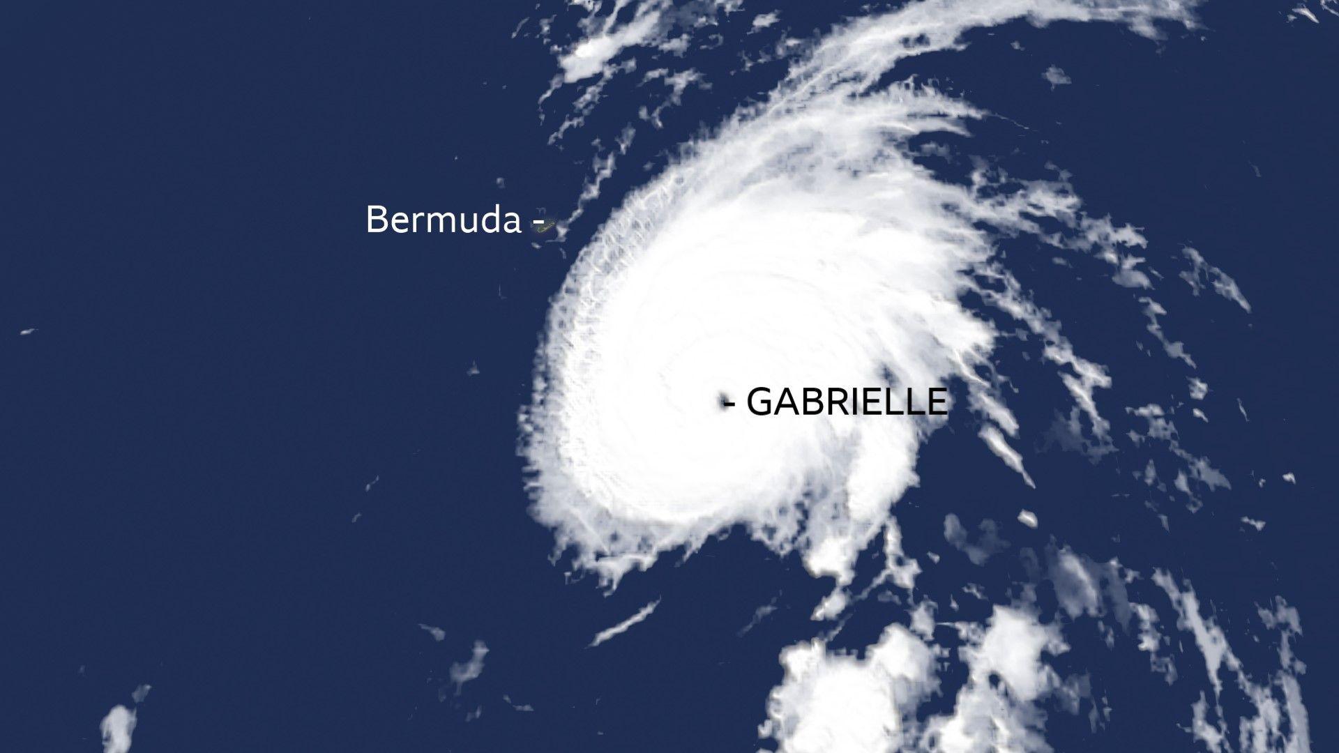 Image source, BBC Weather
Hurricane Gabrielle is predicted to move east towards Europe
A wet start to autumn
This month England received above average rainfall for the first time since January according to the Environment Agency with the week of 12-18 September being the wettest 'for almost a year'.
That was before the heavy rain that fell over Wales and northern England on Saturday that led to flooded roads and disruption to sporting events.
Cardiff has already had twice as much rain this month than in an average September with almost 70mm of rain falling in mid Wales, the Yorkshire Dales and North York Moors.
Between January and August, the UK as a whole has received just 44% of its expected annual rainfall (compared to an expected average of 67% by this stage in the year).
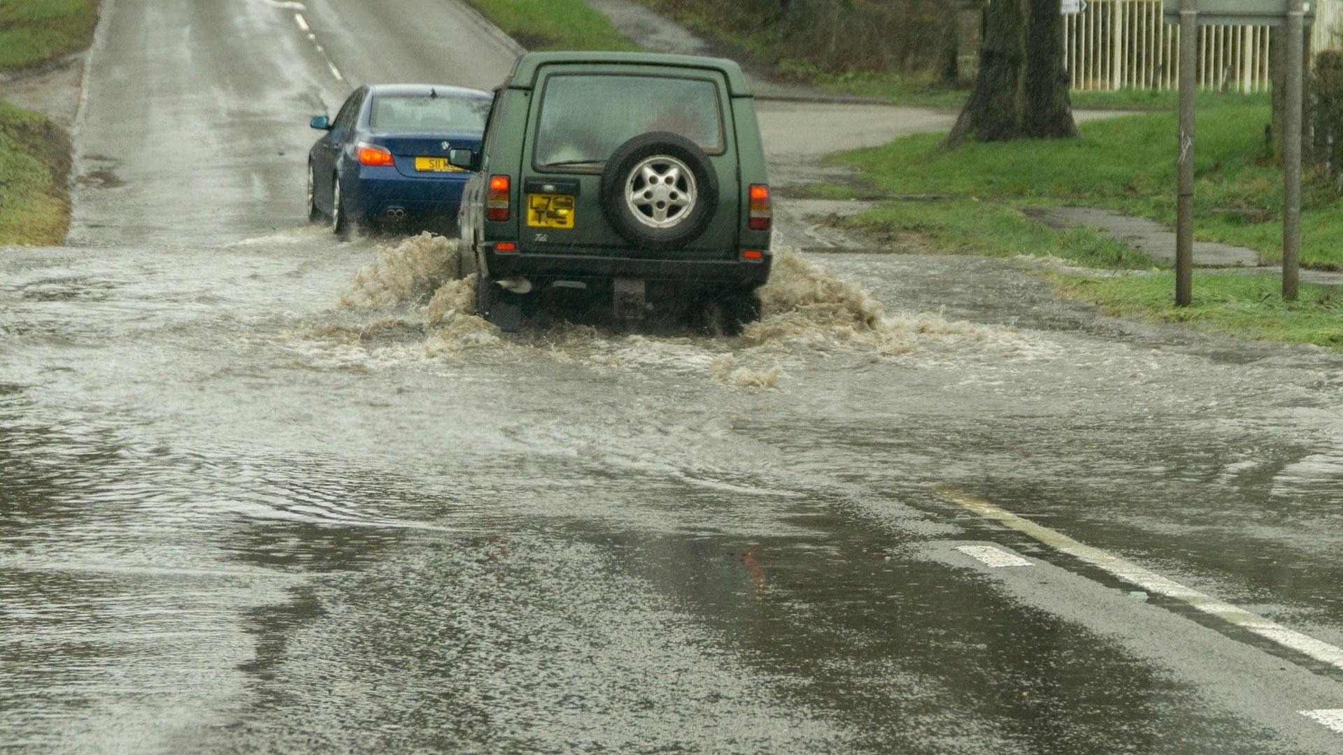 Image source, BBCWeatherwatchers/videoman
Flooded roads made driving treacherous on Saturday
Quiet before a hurricane?
An area of high pressure this week will bring much needed drier weather giving most parts of the UK the chance to dry off ahead of Gabrielle's possible arrival.
Early mornings will be chilly. Monday morning saw a frost in quite a few places. The temperature was down to -0.3C at Edinburgh Gogarbank and at Pershore in Worcestershire – the earliest autumn frost here since 1996.
It will become warmer later in the week as more of a southerly wind develops around the high pressure. And then we await the weekend and the possible arrival of Hurricane Gabrielle.
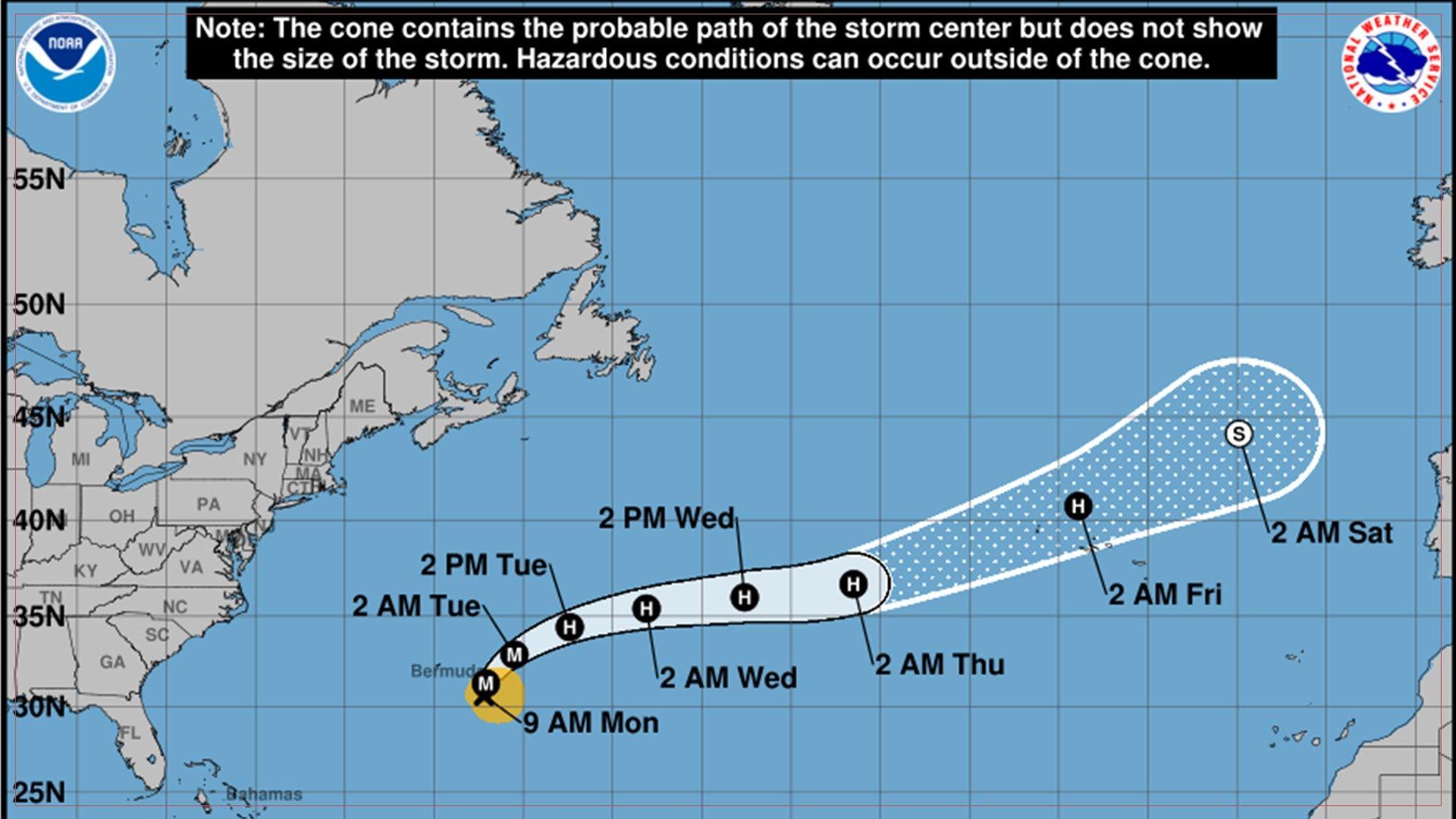 Image source, NOAA
Forecast track of Hurricane Gabrielle issued by the National Hurricane Center
Hurricane Gabrielle
So far this season there have been more tropical storms and hurricanes in the east Pacific than the Atlantic basin. The Atlantic hurricane season has been quiet for multiple reasons but we are now in the peak period of hurricane activity.
Gabrielle is still forecast to be a hurricane on Friday as it travels across the Atlantic to the west of Iberia.
We know that it will weaken at the weekend but there remains considerable uncertainty over where the remains of the hurricane will go with two of the main global weather computer models in disagreement.
The EC model shows a band of rain crossing the UK on Friday night and Saturday with Gabrielle bringing extremely wet and windy weather to Portugal by Sunday.
Whereas with the GFS model the UK stays dry this weekend and Gabrielle spins into the Bay of Biscay bringing damaging winds and rain to northern Spain on Sunday.
It is likely that both these scenarios will change in the next few days.
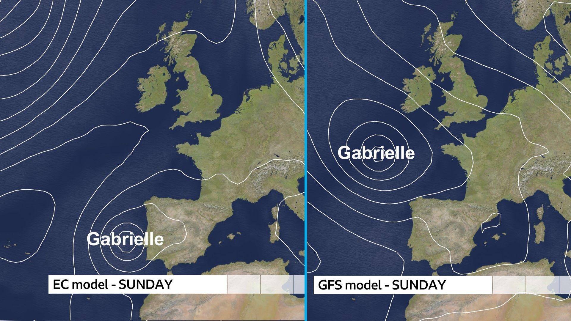 Image source, BBCWeather
Main computer models show ex-hurricane Gabrielle in different places on Sunday
Why the uncertainty?
Hurricanes throw a huge amount of energy and heat into the atmosphere and when they head over the Atlantic they disrupt the jet stream pattern. This is something that historically all computer models have difficulty with which leads to a greater level of uncertainty.
Climate change could possibly add to the uncertainty with hurricanes expected to become more powerful, slow down and rapidly intensify more often.
Stay up to date with how long the dry weather will last and any changes to the forecast track of Gabrielle this weekend on the BBC weather app.