Thunder and hail to batter Sydney after balmy start to Friday
We’re sorry, this feature is currently unavailable. We’re working to restore it. Please try again later.
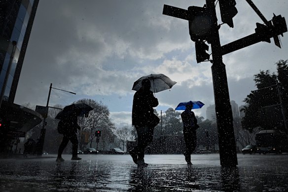
Severe thunderstorms and heavy rain are forecast to hit Sydney and the NSW coast on Friday afternoon, bringing heavy gusts and hail, and threats of property damage and power outages for much of the state.
A cool change from Victoria is forecast to cross into NSW after lunchtime, bringing the storms likely to batter Sydney from about 3pm.
Heavy rainfall and hailstones could batter Sydney on Friday afternoon.Credit: Kate Geraghty
The weather system could drop the temperature by as much as 10 degrees in half an hour, with damaging wind gusts up to 90km/h blowing away the balmy conditions experienced on Friday morning.
Bureau of Meteorology senior meteorologist Angus Hines said it would be a “very active day” for NSW. Coastal areas from Wollongong to Port Macquarie would face elevated storm risks that could also wreak havoc on rural properties in the state’s west.
“If these storms do turn severe, which looks likely to happen later today, the main hazards of these thunderstorms are set to be large hailstones bigger than two centimetres across, which can damage crops, cars and roofs,” Hines said.
“The risk of damaging wind gusts of over 90km/h can lead to property damage, power outages, or just take your rubbish bin on a trip over to the neighbours.”
Sydney woke to warm conditions on Friday morning, and temperatures are forecast to reach 32 degrees in the Sydney CBD and 34 degrees in the western suburbs before the dramatic change.

Lachlan Carlton and Jakob Stephenson soak up the warm spring temperatures at Avalon Beach this week. Credit: James Brickwood
Hines said Friday would be the “peak day” for Sydney’s severe weather, noting there would be “some storminess” for the state’s coastline on Saturday, but the most extreme conditions would transfer to northern NSW and south-east Queensland over the weekend.
“Storms in these areas could tend severe once again on Saturday, with damaging winds and large hail remaining at risk. By Sunday, that risk of storms and severe storms has pretty much completely cleared off the east coast,” Hines said.
“A few showers will still remain, especially around southern Queensland.”
Start the day with a summary of the day’s most important and interesting stories, analysis and insights. Sign up for our Morning Edition newsletter.
Most Viewed in National
Loading