A hot mass of air that built up over the Pilbara and smashed temperature records in the outback will hit Sydney on Wednesday, unleashing a scorching day that comes with high winds, extreme fire danger, risk of a thunderstorm and a severe heatwave warning for parts of NSW.
Records for October heat were broken on Monday in the inland NSW towns of Tibooburra, which hit 42.6 degrees, and Cobar, which hit 40.1 degrees. Similar temperatures for central NSW were forecast again for Tuesday before the heat reaches the coast.
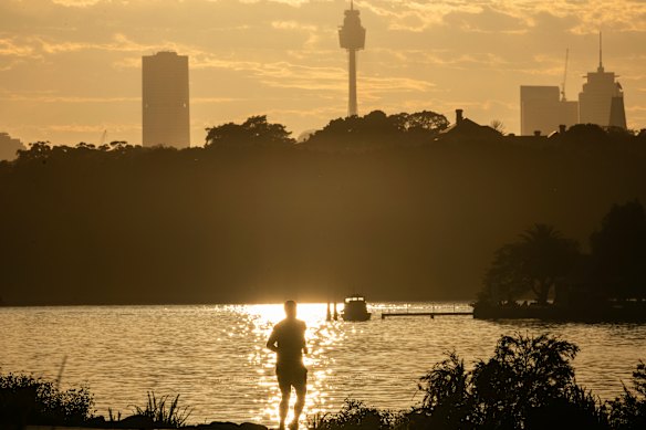
Sydney is set for an unseasonable scorcher.Credit: Steven Siewert
“After today, the heat will push out towards the east coast, with the Sydney Metro area and eastern NSW seeing their hottest day on Wednesday,” Angus Hines from the Bureau of Meteorology said.
“Sydney is forecast to reach 38 degrees … and it could approach 40 degrees in the western suburbs. Alongside these very hot days, there are stifling nights as well, causing heat waves to trigger in some areas.”
If the mercury eclipses 38.2 degrees, Wednesday could mark the hottest October day on record. Based on the forecasted heat, Weatherzone meteorologist Ben Domensino expects the average maximum temperature for this month to come in at 27.1 degrees, which is 5 degrees hotter than normal.
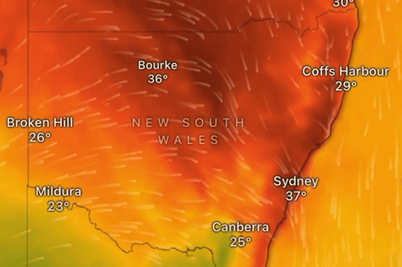
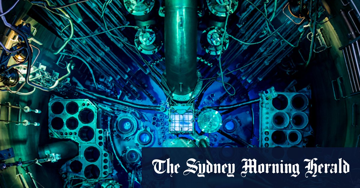
A hot mass of air moving across the country will hit Sydney on Wednesday, as shown by this image from Windy.Credit: Windy
That would not only mark Sydney’s hottest ever October, it would also beat the record for the warmest November.
“No spring month has ever been this hot in Sydney’s meteorological history, which dates back to 1859,” Domensino said.
The record-breaking heat comes after a “sudden stratospheric warming” event over Antarctica. The rare phenomenon has seen heat spike by 35 degrees in a band of air 12 to 40 kilometres over the South Pole.
“We would usually expect southeastern Australia to be drier and warmer after sudden stratospheric warming above Antarctica,” Dr Martin Jucker from the University of NSW’s Climate Change Research Centre wrote in The Conversation.
“In 2019, sudden warming over Antarctica led to drier conditions in Australia. Research has shown this influenced the mega-fires over the Black Summer of 2019-2020. These events can create prime conditions for bushfires.”
The Rural Fire Service has issued an Extreme Fire Danger rating for Sydney, the Hunter, the Illawarra and the Upper Central West Plains for Wednesday. Total fire bans have been issued for all these regions, and north-west NSW.
“Very dangerous fire conditions are expected for the NSW east coast on Wednesday due to the hot, dry and very windy weather, driving extreme fire dangers through the Sydney Metro area,” Hines said. A thunderstorm could strike Sydney and other parts of NSW in the afternoon.
The bureau has a heatwave warning in place for parts of the Northern Rivers and the Northern Tablelands.
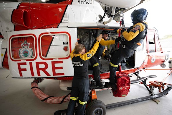
Rural Fire Service crew preparing a helicopter ahead of the extreme fire danger in the Hunter, greater Sydney and Illawarra regions.Credit: Wolter Peeters
Loading
Authorities declare a heatwave when temperatures stay unusually high for three or more days. Heatwaves, which are the deadliest kind of extreme weather event, are becoming longer and more frequent because of climate change, which also increases the chance of abnormally hot days and fire weather.
NSW Health advised people to stay indoors during the hottest times of the day, and to close doors, windows, and blinds early to limit exposure to hot air and sunshine to prevent heat-related illness.
They encouraged those displaying symptoms of a severe illness, such as a sudden rise in body temperature or are no longer sweating, to seek urgent medical attention.
The number of people in Sydney killed by heat could climb by 444 per cent to 520 a year if global temperatures climb by 3 degrees, a National Climate Risk Assessment report found in September.
Start the day with a summary of the day’s most important and interesting stories, analysis and insights. Sign up for our Morning Edition newsletter.
Most Viewed in National
Loading