As it always does, the heat came from the west, building up over the vast interior of Western Australia before crashing across the continent.
When it hit Port Augusta in outback South Australia on Wednesday, the streets emptied, Mayor Linley Shine said. “We’re very used to extreme weather in Port Augusta, so people here generally know how to handle it.”
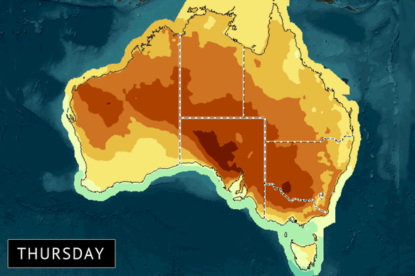
This week’s heatwave spilled across the country from the west.Credit: Bureau of Meteorolgy
One of the town’s residents was more colourful. “It feels like we’re micro-dosing on heat stroke,” said Tata Jane in a comment on social media after the temperature hit the state’s maximum of 46.3 degrees.
It was too much for the local Mr Whippy ice-cream van. In a Facebook post, the van’s owners announced that they were taking a break due to the high temperatures.
Much of Australia is experiencing the worst heatwave in six years, with the mercury climbing over 40 degrees in five states and territories.
“This looks to be … the most significant heatwave event on a multi-day level for inland south-eastern Australia since 2019-2020,” Angus Hines, a senior meteorologist with the Bureau of Meteorology, said.
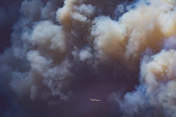
A firefighting aircraft circles the Longwood fire in Victoria as temperatures accelerated fire emergencies. Credit: Jason South
So far, the highest temperature recorded has been at Onslow on Western Australia’s Pilbara coast, where the temperature reached 49 degrees.
Hines said that the heatwave affecting south-eastern Australia started with this build-up of heat in inland and northern WA.
“That’s often called the heat engine of Australia,” he said. “We just see this very hot weather accumulate in the north-west of the country pretty routinely during our summer months.
“And then when the weather pattern changes … the wind can drag that heat and move it to other areas,” he said. “In this case, that hot air is moving in really quickly … so it gets dragged across the desert and it stays extremely warm.”
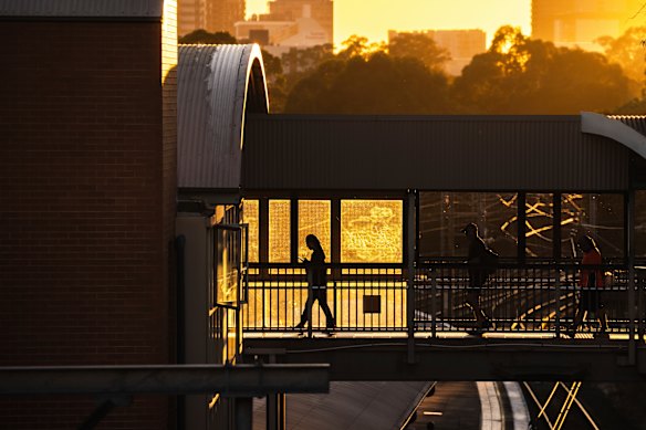
The sun rises over commuters at Westmead railway station during the Sydney heatwave on Thursday.Credit: Sitthixay Ditthavong
“Then that wind which is pulling it in also acts to … exacerbate the potential for fire,” Hines said.
By midweek, temperatures had spilled into the 40s in central Melbourne, while in Geelong the maximum climbed to 43.3 degrees. The Mallee and the Wimmera baked in 44.7 degrees.
Loading
While there was relief for south-eastern Australia on Thursday, with temperatures dropping to the low 30s, authorities were bracing for new dangerous highs on Friday.
Expect “very significant fire conditions across the south-east” of Australia, Hines said, warning of a dangerous combination of intense heat and strong winds. Forecast dry thunderstorms in some areas of the south-east will increase bushfire risk.
“It’s currently looking like we’ll see some areas of catastrophic fire danger,” he said. “Tomorrow’s a nasty day on a number of fronts.”
An extreme fire danger rating is set to cover the rest of Victoria, and a total fire ban has been declared statewide. Emergency warnings have been issued for fires already burning across the state.
Loading
The worst is still to come for NSW, with the heat rising in the west and south of the state and Sydney gearing up to peak on the weekend.
Friday could top out at 33 degrees in Sydney’s CBD and 42 degrees in Penrith. Saturday will be the hardest day for Sydney, with forecast highs of 42 degrees in the city and 43 degrees in the city’s west.
The NSW Rural Fire Service has forecast an extreme fire danger forecast for the Greater Sydney Region on Saturday, along with the Southern Ranges, the ACT, the Monaro Alpine region and the Southern Slopes.
The heatwave is finally expected to ease on Sunday in Sydney, with a high of 26 degrees forecast for both the city and the city’s west, and up to 3 millimetres of rain.
Loading
Climate change is affecting how heatwaves form across the globe. A 2025 study published in Nature, analysing 213 heatwaves that occurred globally between 2000 and 2023, found that “climate change made all events more intense and more likely”.
The study found that one in four of the heatwaves analysed were “virtually impossible without climate change”.
Copernicus, the European Union’s climate monitor, revealed late last year that 2025 had tied with 2023 as the second-warmest year on record.
The warmest year ever was 2024, “the first year with an average temperature clearly exceeding 1.5 degrees Celsius above the pre-industrial level”, according to the organisation’s Annual Climate Summary.
Loading
Australian climate scientist Professor Lesley Hughes said the world was heating in line with predictions.
“As a scientist I’m not surprised by the current heat,” she said.
“It is hard to be hopeful when we see that we’re not acting fast enough ... we must push ahead with strong action on pollution as the next few years are critical to avoiding far worse heatwaves.”
Most Viewed in Environment
Loading